We made it Phoenix as planned on 22 Dec 10 and met Pattie and Rick (Calgary) at the Sky Harbour airport. We had been planning this trip for about 10 months and were getting more and more excited as Dec approached. Pattie and Paulette did a lot of research on accommodations, with plenty available. We ended up with a great two bedroom condo for the 10 days we were away. The trip was going to be busy. We planned to check out Phoenix and the countryside, including Lake Havasu City to the west and the Grand Canyon, Flagstaff and Sedona to the north. Oh yeah, we also had tickets to the Cardinals/Cowboys game on Christmas Day (first NFL game for all of us). Here are a few of the photos we took. Pattie and Rick have lots more, especially those taken from their new camera purchased in Phoenix.

A Natural Beauty

off to the Rental Car garage (what a garage) across the interstate via shuttle bus.

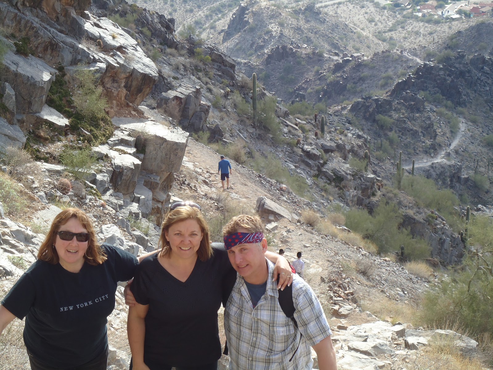
A good first hike on 23 Dec 10 at Superstition Mountain just outside of Apache Junction (east of Phoenix)

A little step closer to the rock outcropping

and a few more steps ....

A great spot for a park bench!

No snow, no jackets, no worries......
Road Trip to Lake Havasu City, Oatman, Kingman(24 Dec 10)

driving west ... mileage signs for Los Angeles just outside Phoenix

The bridge was bought by Robert McCulloch from the city of London on 18 April 1968 for $2,460,000. It took three years and another $4,500,000 to transport and rebuild the bridge. It opened on 10 October 1971. Robert McCulloch is the McCulloch of McCulloch chain saw fame. He bought the land that is now Lake Havasu City back in the sixties and along with C.V. Wood (Master Planner) designed and built the City. Awesome spot, however, it has been hit hard by the recent recession
Besides the London Bridge, Lake Havasu City is also home to Fullsac Performance. If you're looking for a little rumble in your Harley pipes ask Greg M for details

Pattie and Rick in the sunshine!!!
The Bridge was assembled brick by brick on dry land and then the channel cut to connect with Lake Havasu creating an island on the western end of the Bridge. Damage from German air-raids during WWII are evident on the bridge pilings

Original plaque from London

Cool sidewalk along the bridge. Contains a number of "Moments of Freedom" llaques with interesting moments of American History. Also contains thousands of smaller engraved bricks with inscriptions honouring American miliary men and women
Heading north to Oatman!

our first Route 66 sign

We just had to stop and smell the desert air

Rick decides to get personal with a lonely cactus in the desert

after getting aquainted, Rick says goodbye to his lonely cactus (I'm sure that the feeling is mutual)

It is Christmas after all!

Oatman, AZ, population 130, not counting the burrows

nice burrow...

rough stretch of Route 66 between Oatman and Kingman

Arizona Cardinals vs Dallas Cowboys


Cardinals 27, Cowboys 26
Lots of action in the parking lot, on the field and in the stands.
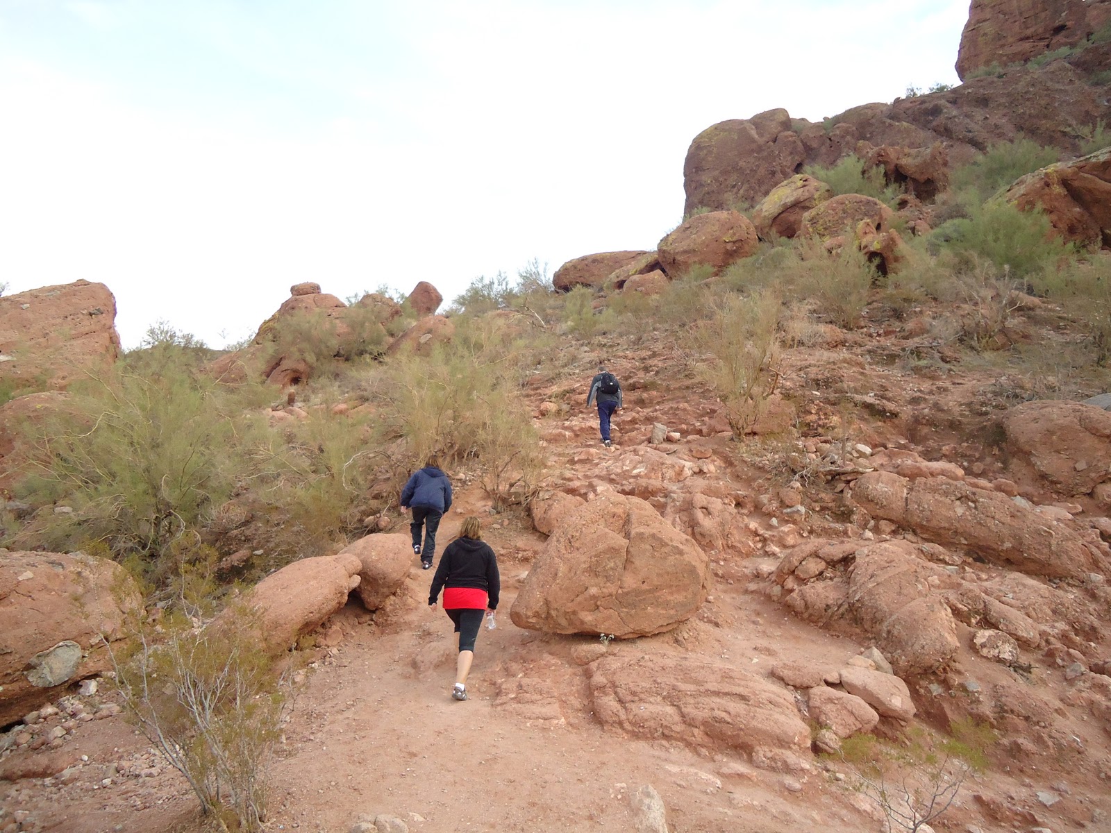
Hiking in Piestewa Peak Park (26 Dec 10)

Summit Trail. Bottom to top = 1.2 miles .. a long winding trail

are we there yet?

ALMOST!

closer, keep it together Paulette!

carry me Brian..
closer...

WE MADE IT! (notice the yellow bag?)
"There are two main attractions at Piestewa Peak: the Summit Trail and the Circumference Trail. The Summit Trail is by far the more traveled. It is about 1.2 miles to the top. The trail itself is rocky, and has a stair effect. There are convenient stops along the way for those of us who either need to take a breath, or those of us who want to get a breathtaking view of the city. The city views are all wonderful, and you don't have to go up very high to see them. The Summit Trail provides a decent workout even for those experienced hikers. It is rated as a moderate hike."
http://phoenix.about.com/cs/sports/a/piestewapeak01.htm
the Grand Canyon
that first view of the Grand Canyon from the rim takes your breath away
 |
| The Grand Canyon is about 277 miles in length measured from Lees Ferry in the east to the Grand Wash Cliffs in the west. |

The Grand Canyon is an average of 10 miles wide in a direct line from North rim to South rim.
 |
| do we look cold? it was a little chilly |

The South rim averages about 7,000 feet above sea level. The North rim is higher, averaging about 8,000 feet above sea level. The rims are about 5,000 feet above the Colorado River that snakes through the canyon with a width that varies between 76 feet to 300 feet and a depth that averages 35 feet, but in places is more than 100 feet deep

Although rocks exposed in the Grand Canyon are nudreds of millions of years old, geologists estimate an age of six million years or less for the canyon itself.

We'll be back, for sure............
Meteor Crater
(between Flagstaff and Winslow Az)
27 Dec 2010
(between Flagstaff and Winslow Az)
27 Dec 2010

"Visit the world’s best preserved meteorite impact site just minutes from Interstate 40 in Northern Arizona near Winslow. Meteor Crater is the breath-taking result of a collision between a piece of an asteroid traveling at 26,000 miles per hour and planet Earth approximately 50,000 years ago.
Today, Meteor Crater is nearly one mile across, 2.4 miles in circumference and more than 550 feet deep. It is an international tourist venue with outdoor observation trails, air conditioned indoor viewing, wide screen movie theater, interactive discovery center, unique gift and rock shop, and Astronaut Memorial Park at the modern Visitor Center located on the crater rim."
http://www.meteorcrater.com/


San Francisco Peaks as seen from Meteor Crater looking west towards Flagstaff
Sedona

beautiful rock formations

very colourful

very rugged.
No photos of the town of Sedona, however, it is quite an active tourist type town, lots of shops,
No photos of the town of Sedona, however, it is quite an active tourist type town, lots of shops,

Catherdal Rock just outside of Sedona
Outside Jobing Arena

... singin' in the rain ...

Papago Park

Hole-In-The-Rock

Papago Park is adjacent to the Phoenix Zoo and also includes some great fishing lagoons
http://phoenix-attractions.10-best.info/papago.html
http://phoenix-attractions.10-best.info/papago.html
5 & Diner (Phoenix)

(awesome burgers & milkshakes)


Camelback Mountain
another 1.2 mile hike straight up - 31 Dec 10

at the start of the trail
going up...

way up there?

two cactii

up or down? up

steep in places

"It took geological nature tens of millions of years to sculpt this masterpiece of sandstone and granite majesty. It depicts a gigantic symbol of a resting camel that constantly gazes the beauty from high above the Phoenix horizon. Alone it set for millions of years until the prehistoric Hohokam Indians settled the area only to mysteriously disappear over a thousand years ago. They left behind evidence of their existence including a ceremonial cave discovered on the north side of Camelback. This ancient religious site motivates many to refer to Camelback Mountain as the Sacred Mountain."
http://www.phoenixasap.com/camelback-mountain.html
http://www.phoenixasap.com/camelback-mountain.html

wait up Pattie ............

pull me Brian

aghhhhhhh

I'm waiting...

I can do it!

we did it!

we all did it!!

amazing view on top of Camelback Mountain